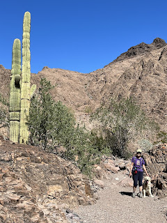
Had a nice 5 mile hike up near Muggins Mountain today. There is a trail that goes around the mountain and we hiked a portion of it. With more planning we could have done the whole trail. Next time. Took several photos.
It was supposed to be 22 minutes from camp. But the map software was not too accurate about the trailhead. We went off down a farm road and went right over the map point. Nothing there. Checked another map and eventually found it. Now, a farm road here is nothing like a farm road in Vt. These are like driving on the top of a levee. One lane wide but 2 way potential traffic. No place to turn off, just hope you don’t meet someone. All roads are a mile long, a neat square pattern. This facilitates planting nice square fields of one section each. Yup, 640 acres of lettuce, or broccoli or whatever. Vegetables as far as you can see.


No comments:
Post a Comment